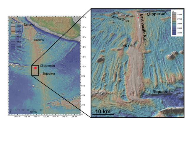
East Pacific Rise Integrated Study Site (2012)

(left) Bathymetry of the East Pacific Rise (EPR) based on data compilation and archiving enabled by the Ridge 2000 Data Portal at the Marine Geoscience Data System (MGDS) (http://www.marine-geo.org/index.php) [Carbotte et al., 2004; Ryan et al., 2009]. (right) Perspective image of multibeam bathymetry for the EPR 2nd order segment between Clipperton and Siqueiros transforms. EPR ISS focused study area near 9°50’N shown by red dot. Black line shows the location of the axial summit trough [Soule et al., 2009] where most of the hydrothermal vents and biological communities are located. Image created with GeoMapApp.
Species (common):
Year: 2012
Details:
Media Type: Map
Data Type: Bathymetry
Device Type: Sonar:Multibeam
Feature: EPR:9N
Investigator: Daniel Fornari
Expedition:
Chief Scientist:
Species:

