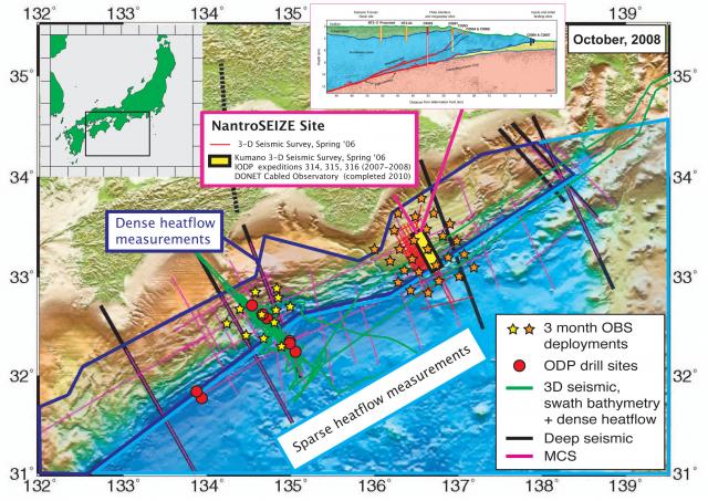
Nankai Focus Site activity map (2008)

MARGINS Nankai Focus Site activity map showing instrument and profile line locations. Sources: Basemap (relief), multichannel seismic (MCS), and 1997-2001 deep seismic lines - Kodaira, NanTroSEIZE Workshop, 2002. 1999 3-D seismic survey, swath bathymetry, heatflow measurements, and 3 month OBS deployments - Kodaira, as above; Bangs, as above; Bangs, SEIZE Workshop, 2003; Moore et al., 2007; and MGDS. ODP sites - Bangs, as above. NanTroSEIZE Phase I-III drilling onboard Chikyu. Kumaro 3-D seismic survey - G. Moore, SEIZE worskshop 2008. DONET - Araki, SEIZE workshop 2008. Cross-section: from Tobin, SEIZE Workshop 2008; Thick red, orange and blue lines indicate current depth of drill holes.
Species (common):
Year: 2008
Details:
Media Type: Map
Data Type:
Device Type:
Feature: NankaiTrough
Investigator: MARGINS Office
Expedition:
Chief Scientist:
Species:

