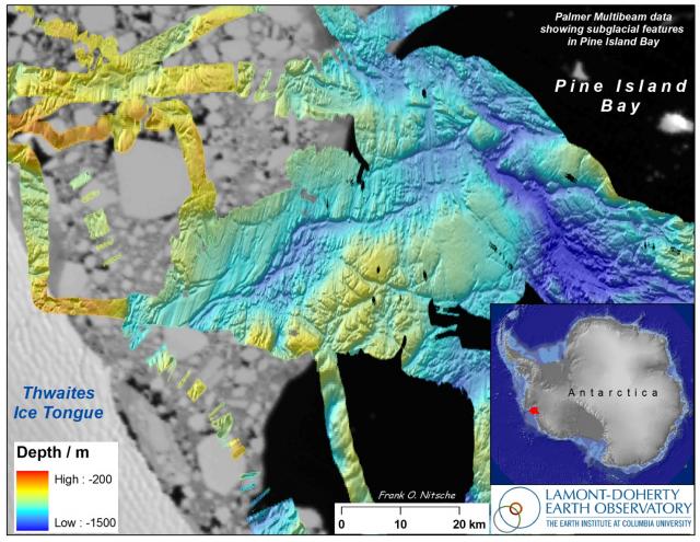
Ocean floor map, Pine Island Bay (2008)
Thu, 05/22/2008 - 15:47 — mgds


Image shows seafloor features caused by glacial erosion during times when the Pine Island and Thwaites glaciers covered this area. Map width is ~180 km. Seafloor bathymetry is embedded within a satellite image of the present ice edge from MODIS.
Species (common):
Year: 2008
Details:
Media Type: Map
Data Type: Bathymetry
Device Type: Sonar:Multibeam
Feature: Antarctica:PineIslandBay
Investigator: Frank Nitsche
Expedition:
Chief Scientist:
Species:

