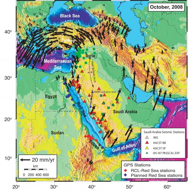
Red Sea Ancillary Site activity map (2008)
Thu, 02/05/2009 - 17:06 — mgds


MARGINS Red Sea Ancillary Site activity map showing instrument and profile line locations. Sources: GPS derived station velocities and existing and planned GPS station locations – Modified from Reilinger et. al., 2006. Saudi Arabia seismic stations and structural features - Preliminary report on tomographic imaging of the Arabian Peninsula by Park, Nyblade, Rodgers and Al-Amri, 2005. Also see Reilinger et al articles in MARGINS newsletters (#17 pages 8-9, 16-17).
Species (common):
Year: 2008
Details:
Media Type: Map
Data Type:
Device Type:
Feature: RedSea
Investigator: MARGINS Office
Expedition: RedSea:Reilinger
Chief Scientist: Robert Reilinger
Species:

